
Redistricting Submissions
Redistricting Submissions
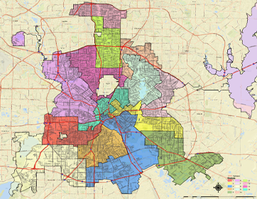
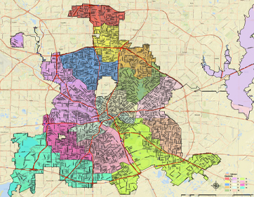
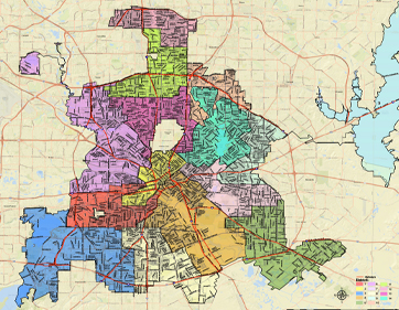
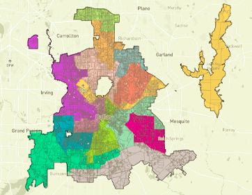
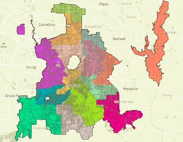
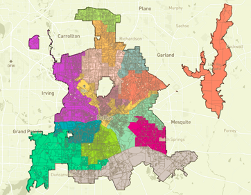
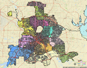
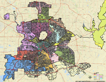
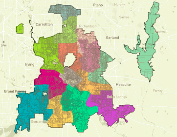
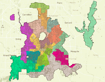
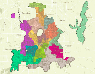
FINAL REDISTRICTING MAP ADOPTED BY CITY COUNCIL ON JUNE 27, 2022
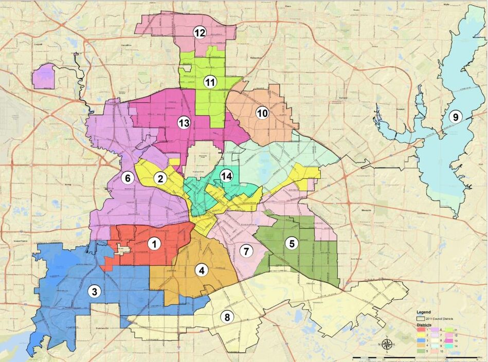
City of Dallas – Redistricting Map Adopted by City Council on June 27, 2022
Analysis: PDF Analysis
Map: PDF
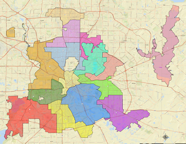
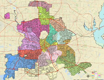
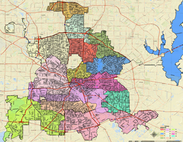
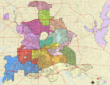
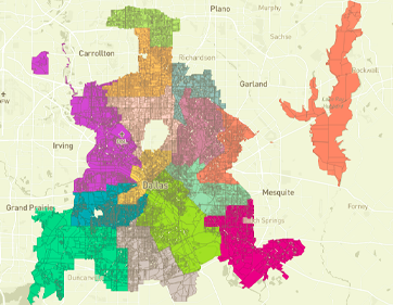
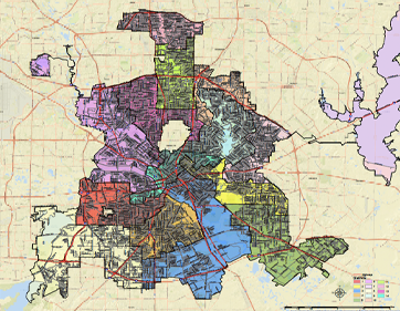
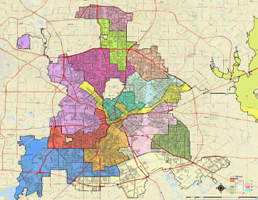
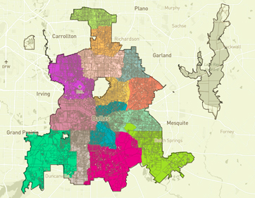
FINAL PLAN SUBMITTED TO THE MAYOR: MAY 16, 2022
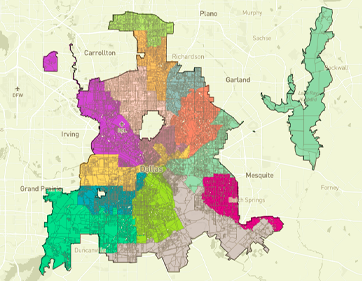
Map ID COD-041-B-FINAL
As amended on 5-10-2022
Analysis: PDF Analysis
Map: PDF
Plan Creator: Commissioner Norma Minnis
Amendment Proposers: Commissioners
Norma Minnis, Randall Bryant, Brent Rosenthal, Bob Stimson
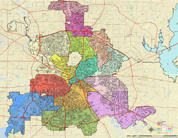
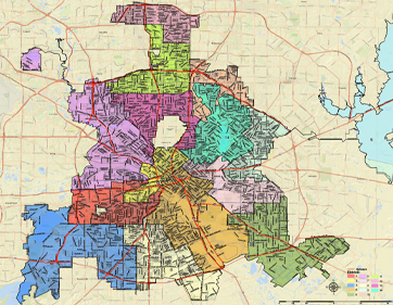
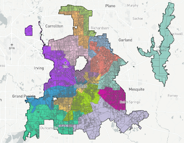
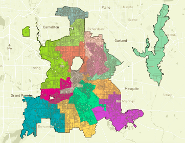
AMENDED PLANS ACCEPTED DURING MAP AMENDMENT WORKSHOP: MAY 9-10 2022
Map ID COD-017-B
Map: PDF
Plan Creator: Commissioners Randall
Bryant, Bob Stimson, Roy Lopez
Amendment Proposers: Commissioners
Domingo Garcia, Randall Bryant
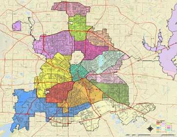
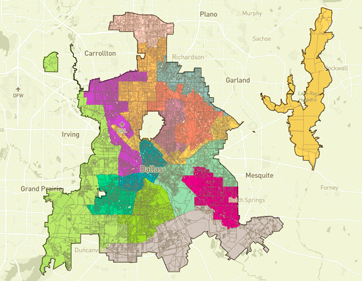
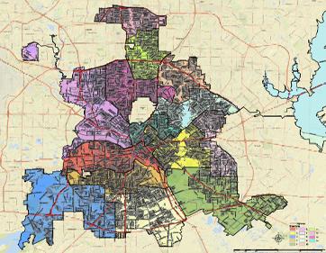
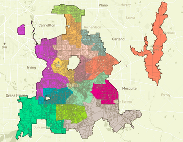
Map ID COD-041-B
As amended on 5-10-2022
Analysis: PDF Analysis
Map: PDF
Plan Creator: Commissioner Norma Minnis
Amendment Proposers: Commissioners
Norma Minnis, Randall Bryant, Brent Rosenthal
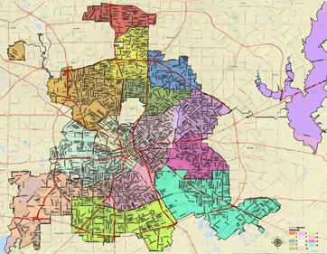
AMENDED PLANS ACCEPTED DURING MAP AMENDMENT WORKSHOP: MAY 2, 2022
Map ID COD-017-A
As amended on 5-2-2022
Analysis: PDF Analysis
Map: PDF
Plan Creator: Commissioners Randall
Bryant, Bob Stimson, Roy Lopez
Amendment Proposer: Commissioner
Domingo Garcia
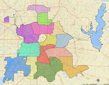
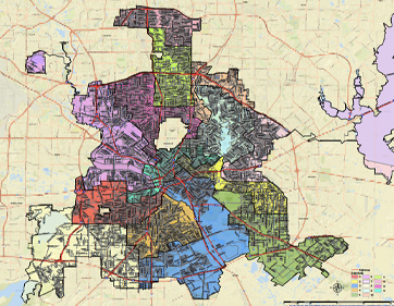
Map ID COD-041-A
As amended on 5-2-2022
Analysis: PDF Analysis
Map: PDF
Plan Creator: Melanie Vanlandingham &
Darren Dattalo
Amendment Proposer: Commissioner Norma Minnis
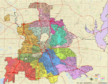
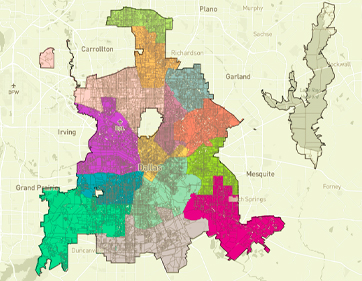
TWO PREFERRED PLANS AS APPROVED: APRIL 25, 2022
Map ID COD-017
Submitter: Commissioners Randall Bryant, Bob Stimson, Roy Lopez
Date: 3.5.22
Analysis: PDF Analysis
Map: PDF
Date Accepted: 3.21.22

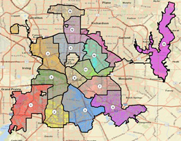
Map ID COD-041
Submitter: Melanie Vanlandingham & Darren Dattalo
Date: 4.15.22
Analysis: PDF Analysis
Map: PDF
Date Accepted: 4.22.22
THREE PREFERRED PLANS AS APPROVED: APRIL 25, 2022
Map ID COD-017
Submitter: Commissioners Randall Bryant, Bob Stimson, Roy Lopez
Date: 3.5.22
Analysis: PDF Analysis
Map: PDF
Date Accepted: 3.21.22
Map ID COD-040
Submitter: Domingo Garcia
Date: 4.15.22
Analysis: PDF Analysis
Map: PDF
Date Accepted: 4.25.22
Map ID COD-041
Submitter: Melanie Vanlandingham & Darren Dattalo
Date: 4.15.22
Analysis: PDF Analysis
Map: PDF
Date Accepted: 4.22.22
MAPS MOVED FORWARD FOR FURTHER CONSIDERATION
Map ID COD-006
Submitter: Bill Betzen
Date: 1.19.22
Analysis: PDF Analysis
Map: PDF
Date Accepted: 1.24.22
Map ID COD-008
Submitter: Bill Betzen
Date: 1.29.22
Analysis: PDF Analysis
Map: PDF
Date Accepted: 2.7.22
Map ID COD-009
Submitter: Jay McDowell
Date: 1.31.22
Analysis: PDF Analysis
Map: PDF
Date Accepted: 2.7.22
Map ID COD-010
Submitter: Jeff Kitner
Date: 2.7.22
Analysis: PDF Analysis
Map: PDF
Date Accepted: 2.15.22
Map ID COD-011
Submitter: Omar Jimenez
Date: 2.8.22
Analysis: PDF Analysis
Map: PDF
Date Accepted: 2.15.22
Map ID COD-013
Submitter: Bill Betzen
Date: 2.10.2022
Analysis: PDF Analysis
Map: PDF
Date Accepted: 2.28.22
Map ID COD-014
Submitter: Jay Mcdowell
Date: 2.12.2022
Analysis: PDF Analysis
Map: PDF
Date Accepted: 2.28.22
Map ID COD-015
Submitter: Bill Betzen
Date: 2.16.22
Analysis: PDF Analysis
Map: PDF
Date Accepted: 3.7.22
Map ID COD-016
Submitter: Sophie/Jeff Kitner
Date: 2.17.22
Analysis: PDF Analysis
Map: PDF
Date Accepted: 3.7.22
Map ID COD-025
Submitter: Bill Betzen
Date: 4.1.22
Analysis: PDF Analysis
Map: PDF
Map ID COD-026
Submitter: Melanie Vanlandingham
Date: 4.2.22
Analysis: PDF Analysis
Map: PDF
Map ID COD-027
Submitter: Kevin Felder
Date: 4.3.22
Analysis: PDF Analysis
Map: PDF
Map ID COD-041
Submitter: Melanie Vanlandingham & Darren Dattalo
Date: 4.15.22
Analysis: PDF Analysis
Map: PDF
Date Accepted: 4.22.22
Map ID COD-043
Submitter: Jeff Kitner
Date: 4.15.22
Analysis: PDF Analysis
Map: PDF
Date Accepted: 4.22.22
Map ID COD-044
Submitter: Sarah Evans
Date: 4.15.22
Analysis: PDF Analysis
Map: PDF
Date Accepted: 4.22.22
Map ID COD-040
Submitter: Domingo Garcia
Date: 4.15.22
Analysis: PDF Analysis
Map: PDF
Date Accepted: 4.25.22
Map ID COD-017
Submitter: Commissioners Randall Bryant, Bob Stimson, Roy Lopez
Date: 3.5.22
Analysis: PDF Analysis
Map: PDF
Date Accepted: 3.21.22
MAPS MEETING REDISTRICTING CRITERIA – NOT MOVED FORWARD
Map ID COD-005
Submitter: Desi Tanner
Date: 1.19.22
Analysis: PDF Analysis
Map: PDF
Map ID COD-018
Submitter: Bill Betzen
Date: 3.10.22
Analysis: PDF Analysis
Map: PDF
Map ID COD-019
Submitter: Bill Betzen
Date: 3.11.22
Analysis: PDF Analysis
Map: PDF
Map ID COD-020
Submitter: Norma Minnis
Date: 3.23.22
Analysis: PDF Analysis
Map: PDF
Map ID COD-023
Submitter: Philip Kingston
Date: 3.23.22
Analysis: PDF Analysis
Map: PDF
Map ID COD-024
Submitter: Philip Kingston
Date: 3.23.22
Analysis: PDF Analysis
Map: PDF
Map ID COD-029
Submitter: Melanie Vanlandingham
Date: 4.4.22
Analysis: PDF Analysis
Map: PDF
Map ID COD-033
Submitter: Kevin Felder
Date: 4.8.22
Analysis: PDF Analysis
Map ID COD-034
Submitter: Kevin Felder
Date: 4.13.22
Analysis: PDF Analysis
Map ID COD-035
Submitter: Ryan Moore
Date: 4.15.22
Analysis: PDF Analysis
Map: PDF
Map ID COD-036
Submitter: William Hoyt
Date: 4.14.22
Analysis: PDF Analysis
Map: PDF
Map ID COD-037
Submitter: Jeff Kitner and Rudi Karimi
Date: 4.13.22
Analysis: PDF Analysis
Map: PDF
Map ID COD-038
Submitter: Bill Betzen
Date: 4.15.22
Analysis: PDF Analysis
Map: PDF
Map ID COD-039
Submitter: Kevin Felder
Date: 4.15.22
Analysis: PDF Analysis
Map: PDF
Map ID COD-042
Submitter: Melanie Vanlandingham and Darren Dattalo
Date: 4.15.22
Analysis: PDF Analysis
Map: PDF
OTHER SUBMITTED MAPS
Map ID COD-001
Submitter: Omar Jimenez
Date: 11.16.21
Notes: Unassigned Units
Map ID COD-003
Submitter: Bill Betzen
Date: 1.13.22
Notes: Contiguity Issues; and Difference between most populated and least populated district is > 10%; Map withdrawn by submitter
Map ID COD-004
Submitter: Desi Tanner
Date: 1.16.22
Notes: Contiguity Issues; Unassigned Units and Difference between most populated and least populated district is > 10%
Map ID COD-007
Submitter: Bill Betzen
Date: 1.21.22
Notes: Contiguity Issues; Map withdrawn by submitter
Map ID COD-021
Submitter: James McDowell
Date: 3.30.2022
Notes: Map not meeting the Redistricting Criteria
Map ID COD-022
Submitter: Melanie Vanlandingham
Date: 3.31.2022
Notes: Map not meeting the Redistricting Criteria
Map ID COD-028
Submitter: Patricia Simon
Date: 4.3.2022
Notes: Map not meeting the Redistricting Criteria
Thank you all for participating in the City of Dallas Redistricting effort.
Thanks
Thank You so much!
Thank you so much.
After multiple failures over the past hour, I shut down again, did a cold boot waiting a full minute before rebooting, and typed in all my data. Something made a difference. It worked. Now I will let the computer fill in the data below.
That worked. Now for the original message:
My second submitted map should be in the submission area in a day or so. I continue to work on a third map, making significant changes. The map now being worked on has 6 Hispanic VAP (voting age population) majority districts, 4 White VAP majority districts, 2 Black VAP majority districts and a strong White opportunity district, and a strong Black opportunity district. A copy of that map is attached and in the Gallery. It is ID 101516.
Continued improvements are needed but we must keep major boundaries as much as is possible in compact districts. I am working on a report on the small number of streets, rivers, and other boundaries between each set of adjacent districts. Look at my Submission #3 map ID: 101516 which is now in the “Work in Progress” folder and attached to this message if that will work.
I welcome questions about using the Districtr software to make maps. It is GREAT software once you know how it works. Just contact me at bbetzen@aol.com or 214-957-9737. Leave a message or text if I do not answer.
– Bill Betzen 1/15/22 2 AM
Dear City of Dallas Redistricting team,
It appears that the problem may have been in my computer and the second cold boot waiting a minute before restarting my computer may have eliminated whatever problem there was. Does that make sense? Anyhow it appears to be accepting public comment now so this is great! Thank you for whatever you may have done to get it corrected.
Do you also think the problem may have been in my need to do a one-minute-wait cold boot with my computer? Or did your work find another problem?
Bill
Just now I again had a problem due to the automatic inserting of data that my computer does. I noticed an error after the URL error notice, and manually input it and it worked. I do not know if that problem will be unique to my computer.
Bill
Here is my final version of Submission #3 ID 101516. The graphics attached is the new map with the current district boundaries inserted so as to demonstrate how much more compact these new districts are.
The chart attached below is another attempt to measure compactness in these City Council Redistricting maps. This first chart counted the number of streets, freeways, rivers, railroad tracks, rivers, etc… that were used to make up the boundaries in the 24 locations on Map ID: 101516 that a boundary existed between two of the 14 Dallas Council Districts. The lower the count the more simple and valuable the map.
The second image takes this chart and inserts it with the most recent version of Map ID: 101516. This was done for illustration purposes if anyone wants to print it out. However, if you want to verify the chart and do your own counting of these segments it is strongly recommended that you go to the Gallery and load up the most recent copy of Map 101516 so you can enlarge it to make precise counting most possible. It is a tedious but valuable process. Here is that link: https://districtr.org/edit/101516?event=cityofdallas
I just realized I made an unnecessary mistake in saving 101516 that had some improvements made to it. The new number is 191652 at the URL https://districtr.org/plan/101652?event=cityofdallas. If I had not tried to direct it to the gallery again it simply would have saved it as 101516. Instead, I made an unnecessary addition to our gallery. This is a learning process! Can you erase a Gallery entry?
I had tried to post two images with one message and apparently that is not possible. Here is the more important image of the Chart to help measure the simplicity of a map, i.e. a map made with the fewest separate streets, Freeways, rivers, railroad tracks etc… used to make the boundaries.
You can now post multiple images
Continuing the search for more capabilities of Districtr, the software we are using here in Dallas City Council Redistricting, I googled and was let to https://districtr.org/guide. It is a very good reflection of the abilities I have had to master in this process. I wish I had studied it months ago and as I was going through this process. I recommend it.
The most unique factor about Map ID COD 006 is that the maximum population deviation, of the 10 percentage points possible, is only 0.8%. The target population is 93,170. The largest deviation was 93,913. I thought that minority populations achieved allowed for relative certainty that 9 minority members would be elected in 9 districts. This is the map and the data on this map: https://districtr.org/edit/102751?event=cityofdallas However, after the map was submitted a wonderful volunteer studied it and gave me the CVAP (the Citizen Voting Age Population) for this map.
It was quickly obvious that while CVAP data showed 2 strong Black districts and 2 strong Black opportunity districts, that same strength did not happen in at least two of the 5 Hispanic Districts. I am now working to use the 4+ percentage points of deviation available to strengthen all maps, especially those two. This is the map I am working on: https://districtr.org/edit/103209?event=cityofdallas.
I plan to attend all meetings to listen closely to all speakers so that the map I am working on can be improved.
Please erase this posting as the map was wrong.
The first step in redistricting should be to study the current district maps and their qualities. The image below is the current Dallas City Council District Map with demographic qualities.
My mistake, the map posted below was the population count per district. As you can see, due to the 31.4% deviation redistricting is mandatory! This map I am now posting is the same map with the demographic distribution by district. Notice that in spite of being only 28% of the Dallas population, White voters dominate. Hopefully, that will change dramatically with the new map.
Now the third map made so as to get to know Dallas is a map made to locate the 14 population centers created in Dallas by the 2020 Census. Notice the population distribution is almost identical for each district. That helps locate the geographic center. The 4th and final map will give the demographic distribution by district with this centering.
This fourth map of the district demographics produced by the centering map emphasizes why the locating of district lines properly will be critical to having a Dallas City Council that reflects Dallas!
I have corrected the 1,000 population of the current Dallas City Council District map that was missing from the version I posted before. These copies include all populations and many additional minor corrections. The first copy tracks the population from 2020 Census in current districts. The second copy gives the distribution by race with the 2020 Census in all current districts.
I see the link for the reference layers on this site. The web visualization is very nice but for this to be helpful I need the shape file for these reference layers. In particular, I need the census block ids located in each of the neighborhoods that are being reported when evaluating maps (or I need the boundaries of each of these neighborhoods so I can infer the census block ids). How does a member of the public download such a file so we can use it for our own evaluations?
Map/Plan ID: COD-017-RB-BS-RL contains an extremely gerrymandered district, District 2, as evidenced by very low Reock, PolsbyPopper, Convex Hull, Schwartzberg scores and should be struck from further consideration for that reason alone.
This proposed district would fracture a significant number of neighborhoods, joining them together in a narrow, snake-shaped district spanning nearly the entire width of the city. At multiple points, the district narrows to only 2-3 blocks in width as it clips off portions of fragmented communities.
The proposed district would be so vast, incoherent and disjointed as to effectively deprive its 97,000 constituents of effective representation. Residents of this district attempting to advocate on behalf of hyper-local issues would face steep roadblocks in obtaining public support, because most of their neighborhood would be contained within the periphery of adjoining districts.
Beacuse this map would effectively disenfranchise the 97,000 residents of proposed district 2, it should be eliminated from further consideration.
Anthony, you are absolutely correct. This is also true of several other districts in map COD-017. This has been a problem with District 8 for decades and is not changed in this map.
I do hope we can continue to have diversity on our city council. But a map that splits up neighborhoods and creates shapes and boundaries to maximize majority minority districts with no consideration for the issues that neighborhoods have in common within a district is not the way to go. Many, but maybe not all, map drawers seem to have no understanding of the issues in the various areas throughout the city. A district that is created solely based on demographics does not serve the city or the members of the newly created districts well. A perfect example is District 14 which the map drawers are chopping up and reapportioning to newly created surrounding districts that have no common issues like the current District 14 has. You can reduce the population in District 14 by lobbing off the north east section above Lovers, Mockingbird or Patrick Dr. I urge the diligent and dedicated commissioners to listen closely to what the people of Dallas have been telling you when they have spoken out at your meetings. They might be willing to accept minor changes in their district boundaries, but they clearly don’t want drastic changes like we are seeing in the maps that are being “accepted for further consideration”. If you present a map with draconian changes to the mayor, there will likely be much wailing and gnashing of teeth as the city council redraws your map to be something more reasonable, creating a lot of unnecessary angst and wasting a lot of time as we aim to create fair representation on city council.
Sadly Joan since 1991 and the first single-member district map used in 1991, terribly gerrymandered maps have driven the attempts of those against single-member districts, generally those represented by the Citizen’s Council, to stop the minorities in Dallas from being proportionately represented on the City Council. Such gerrymandered maps have continued through today. We must move away from such map-making except when it is validly used to increase the uniting of a minority community. That is legal.
Major changes are needed if we want to correct decades of injustice. Here is a description of the meeting over 10 years ago that selected the current Dallas City Council District maps: https://www.dallasnews.com/news/2011/10/06/a-split-dallas-city-council-approves-redistricting-map/
Hopefully this year we can be more proud of what will happen in public. We must follow the rules made public for redistricting equitably.
Joan, I failed to mention the probability that most of the current Dallas City Council Members may be redistricted out of their districts for one very painful but simple reason, 30 years of gerrymandering to hinder and lessen the power of the Dallas Minority Community to freely represent themselves. This was done by the Minority Community being plagued with unnecessarily and strangely shaped districts that were expensive to run a campaign for office in. Consequently, candidates often became used to being dependent on North Dallas donors to fund their campaigns. It was no mistake that Southside districts were always elongated and in strange shapes. Hopefully, that painful history will come to an end with this redistricting process.
After hundreds of hours constantly improving 60 maps, here is Map 61, saved in the Gallery, which is the best map of any made to date in providing the 9 strongest minority districts possible. It provides 4 strong winnable districts for both the Dallas Black Community and the Dallas Hispanic Community. A ninth district is a Minority Opportunity District wherein the minority community can unite to elect a City Council Representative of their choice. There are 5 majority White districts.
It can never be said stronger maps are not possible. I challenge everyone to work to provide a strong minority representation map. The City Council must reflect Dallas. This will be a major change for Dallas as the 31 years of gerrymandered minority districts so as to weaken the minority vote and power in City Hall must come to an end!
It is presumed many current council members will no longer be living in the districts they represent as gerrymandering unnecessary to improve minority representation has been eliminated in the construction of these 61 maps.
Bill, I know you ave out a lot of time ad effort into map drawing and we appreciate that. But you might wish to take a look at the city’s campaign funding report before making a gross generalization about the source of campaign funds, especially if your goal is to Gerrymander them out of office. https://campfin.dallascityhall.com/
Joan, it would be unethical for anyone to work on a redistricting map with any goal to include or exclude potential individuals from running for office. It is sad that it required a change in the Dallas City Charter to clarify that reality but in the 2011 Redistricting process City Council leaders openly spoke of changes needed to include candidates in a district. Now that is clearly against the Charter.
When I made this statement above, “It is presumed many current council members will no longer be living in the districts they represent as gerrymandering unnecessary to improve minority representation has been eliminated in the construction of these 61 maps,” I was simply clarifying. As the extensive gerrymandering in the 2011 Dallas City Council District Map was eliminated it is only natural that some current City Council Leaders would no longer be in the same districts. It is only natural. Once this correction has been made, future redistricting should not involve as many disruptions of leadership except for those who may be living near boundary lines that must be moved due to population changes. The goal is always to minimize the distance between the extremes in all districts so the potential for candidates to be distant from all those they represent is minimized. District 8 in the current district map is the greatest offender in this area.
From the very start of single-member districts for the Dallas City Council massive unnecessary gerrymandering was used to hinder leadership in minority districts. It all started with this 1991 map. That is the major issue we fight. It is consistent with every LWV goal to increase voting and active civic engagement.
Here is a 30-year history of Dallas City Council Redistricting Maps. It goes from the very first one after the war for single-member districts was won in 1991 through 2001 and finally the 2011 map we are now living under. Hopefully, the 2022 approval of a City Council Redistricting map will not be as much of a fight as the 2011 process endured as described in this article at the time: https://www.dallasnews.com/news/2011/10/06/a-split-dallas-city-council-approves-redistricting-map/
To ARC Bridge Consulting – please remove the word “Approved” when referring to maps and replace it with “Accepted for further consideation”. This language was decided by the Commissioners several meetings ago.
Thanks for your comment. We will make the change from Approved to Accepted for all maps in the MAPS MOVED FORWARD FOR FURTHER CONSIDERATIONsection.
Sam
Dallas needs to know that on 3/28/22 a major error in the Districtr software was suspected and reported to Dallas City Staff. They immediately reported the inconsistent data to the consultants who sent the statements of concern to Districtr. By Friday Districtr had verified the problem and corrected it.
What was happening is that while Hispanic VAP numbers were correct, both the WVAP and BVAP numbers were double-counting those Hispanics who also identified as White or as Black on the 2020 Census.
This double-counting was leading to a massive overcount in WVAP numbers as many Hispanics also identify as White, and a lower overcount in BVAP due to the number of Hispanics who also identify as Black.
The good news is that the error has been corrected. The bad news is that all reports generated from Districtr before 4/1/22 are in error. Here is an illustration of the changes. I welcome questions.
Here is something that should have been posted long ago about saving maps.
The Dallas White-non-Hispanic census count as a percentage of Dallas population has declined constantly for decades. In 1990, when single-member Dallas City Council Districts were about to be mandated by the courts, it fell below 50% for the first time in the 10-year Census. Hopefully, with the 2022 Redistricting, the gerrymandering that has allowed a winnable White-non-Hispanic majority of districts to remain on the City Council map these past 30 years will be eliminated to have 9 strong and winnable minority districts. Please share if you agree.
It is surprising that this data is not easy to find online and in one location. Here are the sources that verify this data originally from the normal 10-year U.S. Census:
The data for 1930 is found at https://worldpopulationreview.com/us-cities/dallas-tx-population. It is stated on that page that “The community of Dallas has historically been mostly white, with non-Hispanic whites accounting for 83% of the population in 1930”
The data for 1990 is found on the 703 page 1990 Census report at https://www2.census.gov/library/publications/decennial/1990/cp-1/cp-1-45-1.pdf
On page 93 of that document, you will find that 479,980 of the 1,006,877 Dallas 1990 population were White-non-Hispanic. That comes out to 47.67% of the Dallas population.
The data for 2000 and 2010 is verified on page 20 of the census document at https://dallascityhall.com/departments/strategicpartnerships/redistrictingcommission/DCH%20Documents/RED_briefing_040611.pdf.
The data for 2020 is verified at https://www.dallasecodev.org/490/Demographics.
The above references are for the data in this chart.
If the image of the chart comparing the winnability of the final dozen maps regarding the minority winnability of the various maps does not post with this message, it can be seen with the most recent posting at http://billbetzen.blogspot.com/
Below is a chart of the Dallas City Council Redistricting maps being studied for selection by the Commission and then to use as a platform for any amendments needed. They are the maps that best achieve the Civil Rights goals of maximizing minority participation in our Dallas City Government. These maps produced the most districts that have the highest potential for selecting a minority candidate. It is clearly shown that 9 winnable minority districts are possible. It also shows that 5 winnable Black Districts are possible but not without destroying the potential for a 4th Hispanic District and a 9th winnable minority opportunity district.
In an attempt to measure winnability three different measurements were used: ppb, pph, and ppw. They tell the strength of a minority group in winning a district by telling you how many percentage points exist between the highest VAP (Voting Age Population) percentage racial/ethnic group in a district and the next highest percentage racial/ethnic group. It then identifies that second-place group as either Black, Hispanic or White-Non-Hispanic. This measurement system is used throughout the chart to achieve some objectivity. Since we know CVAP percentages are generally only about 61% of Hispanic VAP percentages but average over 30% higher than Black and White-non-Hispanic VAP percentages, we can make winnability estimations accordingly.
Obviously, this is only a crude measure, but it lends some level of objectivity to a very human process.
To double-check the calculations I have made in this chart it is recommended you randomly select any number in the chart and check it with the identified map
VAP data for the district you want to check. Please let me know immediately if you find any errors. I hope there are none, but it is very possible as this involved multiple calculations.
The numbers 1, 2, 3 & 4 at the top of the four columns for Black Districts and for Hispanic Districts are simply to identify the columns and not to be confused with district numbers. The goal is 4 winnable districts each plus the Minority Opportunity District in the last column as the ninth winnable district.
I value any questions you may have. The chart is below. My email is bbetzen@aol.com.
from what was selected as finalists it appears that race was the primary criteria rather than making the districts as compact as possible and as close to the ideal populatin number of 93,169. Deviating from that number by as much as 10% violates IMHO the concept of “1 man, 1 vote”
I prefer Map ID COD-041. The map gives more compactness, which insures the districts can speak as one voice. The southern districts have been gerrymandered to the benefit of the northern districts for far too long. Geographically spreading of districts dilute the ability of a district from speaking with a common voice. I like what Map 41 does for our city.
It is imperative that the committee reject proposed redistricting Maps 17-A 127653 and 41-A 127697 as they do not properly represent the demographics of our city and unfairly underrepresent BIPOC communities.
We need proper representation as displayed in the People’s Map.
PLEASE stop the gerrymandering and provide proper representation to ALL our communities.
I am signing up to speak at the City Council Briefings and meetings in support of the People’s Map being considered. Email me and I can send you what is being submitted to explain the multiple benefits of the People’s Map. bbetzen@aol.com is my email.